Retrospective journal · October 17–29, 2026
When I first asked about adding terrain to CDW, I wanted to start with generated landscapes. A location or a map could come later.
That kept the first question fairly direct: how could a set of plotted lines describe terrain?
The drawings did not need to represent a particular mountain yet. They gave us somewhere to work on contours, slopes, overlapping forms, and the marks that would make those forms readable. The eventual output still had to be paths that my AxiDraw could draw on paper.
From a surface to a set of marks
The early relief discussion included a practical requirement: lines hidden behind the terrain should not remain visible through it. It also proposed a limited shading system, using strokes running down the slopes and density influenced by the light.
Those were things to prove, not reasons to assume the drawing was finished. A convincing surface on screen and a useful pen drawing still required separate attention.
The paper studies show several ways of describing the forms. Some use lines that run down from the ridges. Others wrap around the hills as contours. Some add a second family of marks in red. Across the sheets, the forms range from rounded hills to sharper groups of peaks.
That variety gives me something to compare. A contour describes a different relationship to the surface than a stroke descending a slope. A crossing set of lines can make the construction more explicit. An area of close hatching can give one part of the drawing considerably more weight than another.
The question becomes more specific than whether the terrain looks mountainous. Which marks are doing useful work, and which are making the drawing harder to read?
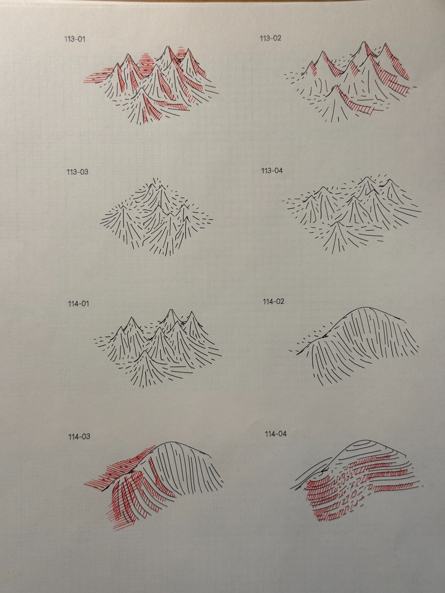
Terrain studies comparing peaked and rounded forms, descending lines, contours, and red hatching.
What happens when a line breaks?
One of the larger comparison sheets places a contour reference above a version labeled “Long Middle / Dashed Outer Quarters.” The labels record the same view, light, relief, source spacing, and seed for both examples.
The marks themselves make the comparison accessible. Long curves hold parts of the hill together, while shorter marks leave more of the paper visible. In the second example, the breaks reach into different parts of the drawing.
This is the kind of test worth keeping on paper. I can look across the two panels rather than rely on remembering what the previous setting looked like. The annotations provide a route back to the experiment, while the drawing gives me something to judge.
The smaller sheets extend the comparison through stepped contours, crossing lines, descending strokes, and much sparser arrangements. They preserve several possible drawing languages rather than a single answer.
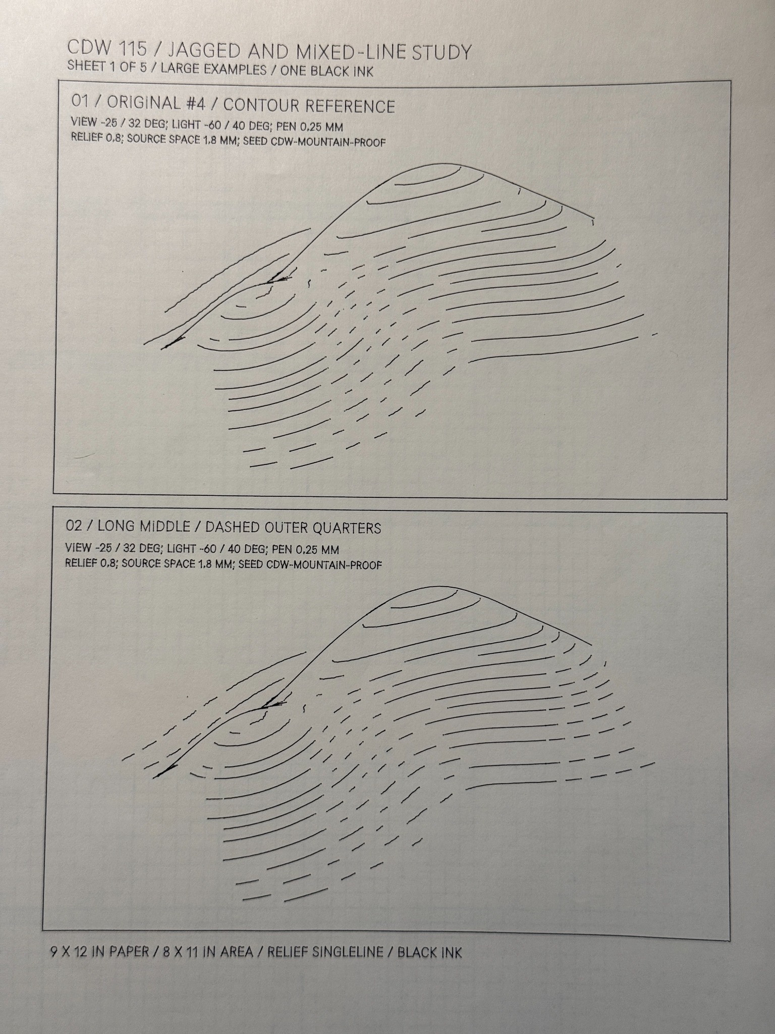
A larger comparison sheet pairs a contour reference with a treatment labeled “Long Middle / Dashed Outer Quarters.” The plotted annotations record matching view, light, relief, source spacing, and seed.
Where the mountain meets the ground
Later in October, the discussion became much more specific about mark-making.
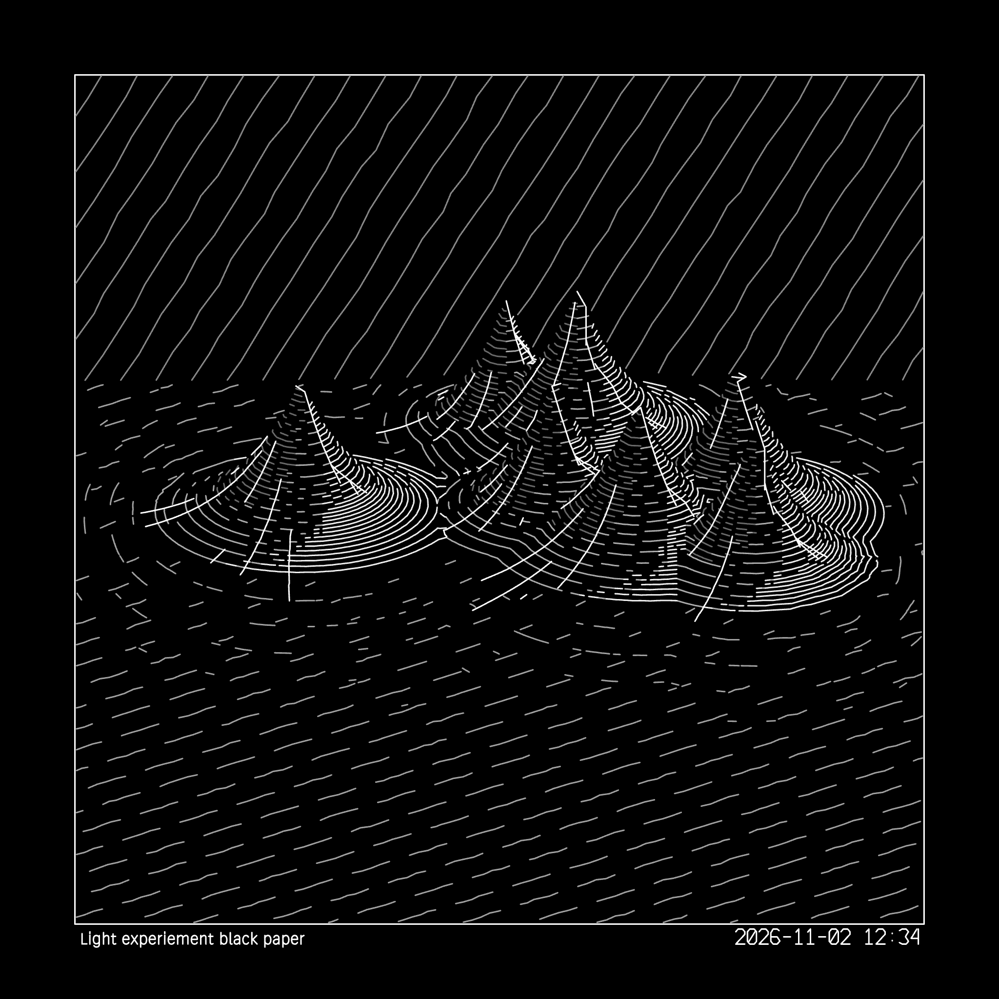
In a project called Terrain Base Interleaving, I could see part of what I had been trying to describe: the midtone marks narrowed toward point-like endings. The ground lines were not behaving in the same way, and the available treatments still were not giving me the result I wanted.
The terrain-following contour fade was closer. But the line nearest the terrain remained solid, with increasingly separated concentric lines farther out. Reducing the reach of that fade helped, and progressive dashes were working better.
That was useful feedback to bring back into development. I could identify a behavior that was closer to the intended marks and another part that still needed work. It did not mean the ground transition was solved.
These early terrain studies gave us a way to examine those differences. The subject was a landscape, but the work kept returning to line length, spacing, direction, and the places where a mark should stop.
Real elevation data would bring another set of questions. First, these generated hills gave us room to work on how to draw.